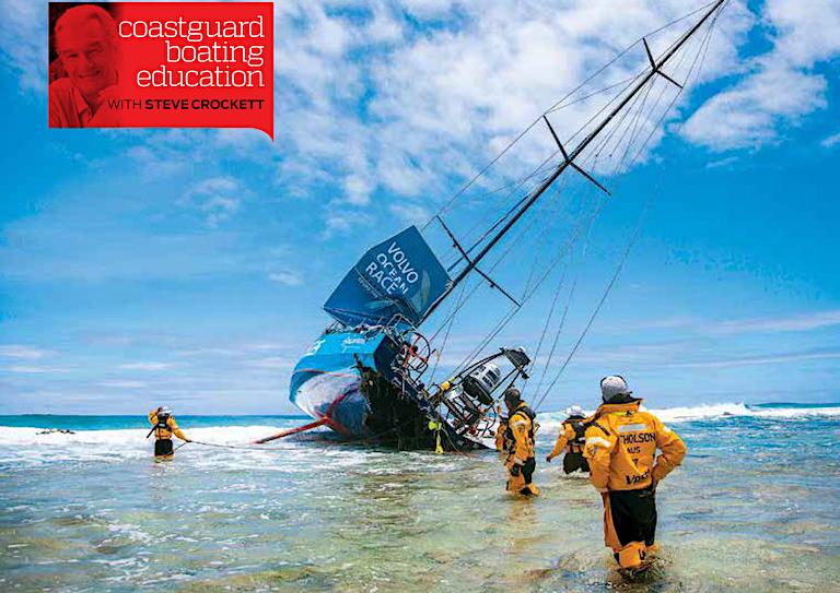
BLINDLY RELYING ON A GPS CHARTPLOTTER CAN LEAD TO TROUBLE. JUST ASK THE VOLVO OCEAN RACERS FROM TEAM VESTAS WIND.
I find my iPad to be such a useful piece of kit. I store all my books on it. I can access emails,
visit Facebook, and best of all I can use a marine chartplotting application to see where I am. But there are so many advantages to these apps that sometimes we tend to overlook their limitations.
Recently, while firing up the plotter on my mate’s boat, I paused when the disclaimer screen appeared.
For some inexplicable reason I decided to read it.
“Navigation warning, “ it said. “No national hydrographic office or official agency of any country has verified the data or information in this product.”
Really? Interesting. So what else was out there?
Another read: “Do not use this document and software to replace actual navigation training and experience, but as a valuable navigational aid.”
Yet another told me: “Nautical navigation is an inherently dangerous act and this product is only a navigational aid,” which, ” … must only be used in conjunction with approved paper charts and traditional methods of navigation.”
Now, you may think that this is simply a butt-covering exercise by the manufacturers to avoid being sued. Thousands of people all over the world are using these products every day without any real problems. Right?
We know where we are in the world now – unlike in 1707 when Sir Cloudsley Shovell achieved infamy by wrecking the entire British Fleet upon the Scilly Isles.
We have graduated from pencils to pixels. We have MDSS, DSC, AIS, and ECDIS.
As Russell Crowe’s character Jack Aubrey states in Master and Commander: “What a marvellous modern age we live in!” What could go wrong? How about these: In 2006, a recreational vessel drove onto a rock wall in Brisbane while navigating at night using chartplotting software that was out of date.
In 2011, the container vessel Rena ran aground on the Astrolabe Reef in the Bay of Plenty. That navigating officer chose to override the system and failed to account for tidal set and drift.
Last year in the Volvo Ocean Race, Team Vestas Wind grounded on Cargados Carajos Shoals doing 19kts, in the middle of the Indian Ocean, at night. The navigator had failed to zoom in far enough on the chart to see the reef in detail. These are but a few of the many reported and preventable accidents to have occurred recently. What these show are the consequences of using a chartplotting system as the sole method of navigation without having any checks and balances in place.
Do you really understand what you are looking at when you use a chartplotter? Does your system rely upon raster or vector charts? Do you know the difference? Where can you check that your Electronic Navigation Charts (ENC) are up-to-date? Do you understand that, unlike paper charts, two skippers n different vessels using different equipment could be looking at entirely different chart images?
If you really wish to know how to use your GPS plotter as the brilliant aid to navigation that it is, I suggest attending a GPS or Electronic Navigation course run by Coastguard Boating Education. This will assist in obtaining the optimum performance from your device. You will learn how to add and remove layers from vector charts, and how zooming in can give you more information.
You will learn the differences between official hydrographic chart information and community layered additions. You will even appreciate that some charting software – like many magazine supermodels – may have had a few of the lumps “smoothed” out.


No Comments